Kolkata Historical Archives

History of Sealdah | Railway Station, Heritage & Evolution of Kolkata

Explore the complete history of Sealdah, Kolkata. Discover its etymological roots as Shrigaldwipa, Nawab Siraj-ud-daulah's 1756 battle, the 1862 incorporation of Eastern Bengal Railway, and its growth into one of India's busiest transit corridors.
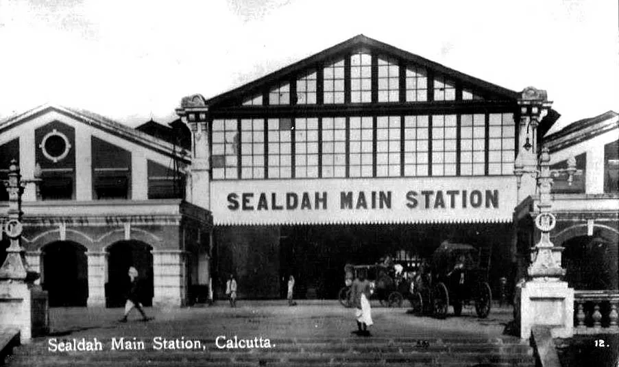
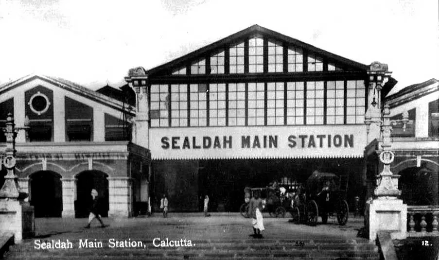
Sealdah History: Historical view of Sealdah station facade
HERITAGE IMAGE ARCHIVEOld Sealdah Station Clock Tower Facade
Est. 1862
Origin NameShrigaldwipa (Jackal Island)
1756 CrossingNawab Siraj-ud-daulah
First Terminal1862 Tin-Roof Shed
ArchitectWalter Glanville (1869)

1. Introduction & Historical Significance

Sealdah is the beating heart of Kolkata. Serving as the primary gateway linking the city with suburban districts, North and South 24 Parganas, and Nadia, it is one of the densest transit and commercial corridors in the world. Historically, Sealdah played an instrumental role in shaping the urban geography of early Calcutta, transforming from a marshy wetland into a major railway terminal during the 19th century under British colonial rule.

Beyond transport, Sealdah is a cultural melting pot where legacy printing presses, wholesale markets, medical institutions, and schools are located. By acting as the central hub for local passenger rail and road networks, Sealdah has powered Kolkata's trade, education, and social movements for over 250 years.

2. Meaning & Etymology of "Sealdah"

The name Sealdah carries geographical clues about Kolkata's early landscape. It is derived from the Bengali words 'Sheal' (jackal) and 'Daha' (pool, lake, or water basin). In ancient records, the area is referred to as Shrigaldwipa (Jackal Island). Before the marshes were drained, this area was a low-lying wetland populated by wild jackals roaming around pools of water.

A parallel historical name is Baithakkhana (literally a sitting room or gathering place). This refers to a massive Peepul/Banyan tree that once stood in the neighborhood. Merchants and travelers arriving from the eastern districts of Bengal would gather and rest under this tree before formally entering the city boundaries to trade.

3. Early History & Salt Lake Marshes

Before British colonization, the region was an expanse of tidal salt lakes, marshes, and creeks. The early settlements were scattered agricultural villages. In the early 18th century, Sealdah was part of the Dihi Panchannagram, a collective administrative boundary of 55 suburban villages outside early Calcutta, which the British rented and consolidated to expand their trading base.

Trade routes naturally intersected here due to the proximity of the canal port systems. Merchants brought vegetables, rice, fish, and paper via country boats through the canal channels, laying the foundation of Sealdah's wholesale trade hubs.

4. The Colonial Period & Siraj-ud-daulah Siege

During Nawab Siraj-ud-daulah's siege of Calcutta in 1756, Sealdah became an active battlefield. The British had dug the **Maratha Ditch** (running along APC Road in Sealdah) to prevent invasions by Maratha Bargi horsemen. The Nawab's royal troops crossed this ditch at Sealdah, engaging the East India Company forces in the local rice fields before successfully capturing Fort William.

Following the Battle of Plassey, the British filled up the Maratha Ditch in 1799, converting the reclaimed land into roads. This led to the expansion of Circular Road (APC Road) and the development of Dalhousie and Sealdah into structured municipal grids.

5. Birth of Sealdah Railway Station

The **Eastern Bengal Railway** company was incorporated in London in 1857 to construct a rail link from Calcutta to the eastern districts of Jessore, Dhaka, and Kushtia. The Sealdah Station terminal opened in 1862 with a simple tin-roofed passenger platform.

To accommodate growing traffic, a permanent brick terminal building designed in British neoclassical style by architect **Walter Glanville** was completed in 1869. The station expanded rapidly with the introduction of steam locomotives, eventually becoming nationalized in 1884 as a strategic transit line of the British empire.

6. Sealdah During Independence & Refugee Crisis

The partition of India in 1947 completely altered Sealdah's demography. As the primary railway link to East Bengal, Sealdah Station became the landing ground for millions of Hindu refugees fleeing East Pakistan. For years, the station lobbies and surrounding fields functioned as massive transit refugee camps. This influx powered the growth of local colonies and expanded the city's labor footprint.

7. Evolution of Transport

Sealdah's transit history is a timeline of technological shifts:

Colonial Phase

Horse-drawn carriages, manual handcarts, and steam passenger trains connecting Sealdah to Kushtia (1862).

Mid 20th Century

Electrification of tram cars (1905) and suburban local trains (1950s) allowing fast daily commuter inflow.

Modern Phase

Sealdah Flyover (Vidyapati Setu) and the deep East-West Metro linking Sealdah to Sector V and Howrah (2022).

8. Historic Buildings Around Sealdah

The neighborhood surrounding Sealdah is home to several monumental structures of architectural and medical heritage:

Bow Barracks

Unique red-brick quarters built during WWI in Bowbazar to house British troops.

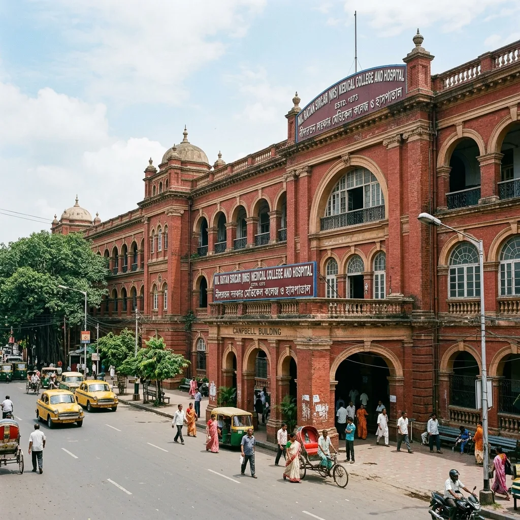
NRS Medical College

Founded in 1873 as Campbell Medical School, it features vintage red brick clock towers and halls.

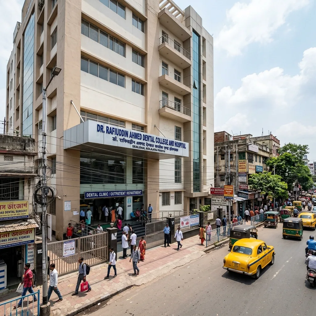
Dr. R Ahmed Dental College

Established in 1920 by Dr. Rafiuddin Ahmed, it is the oldest dental school in India.

B.R. Singh Railway Hospital

Historic hospital built in 1934 by the Eastern Bengal Railway to treat transit staff.

9. Education Heritage

Sealdah is adjacent to **College Street**, the academic nucleus of the Bengal Renaissance. Institutions like **University of Calcutta** (1857), **Presidency University** (1817), **Scottish Church College** (1830), and the historic **Calcutta Medical College** (1835) are all situated along this corridor, serving as intellectual hotspots where freedom fighters and scholars trained.

10. Markets Around Sealdah

Commerce is Sealdah's lifeblood. The neighborhood hosts various historic markets:

  • Kolay Market: One of the largest wholesale vegetable trading yards in Asia.
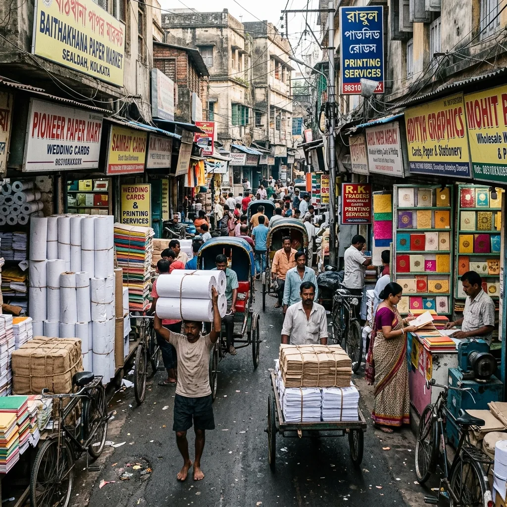
  • Baithakkhana Paper Market: The largest paper trading market in Eastern India.
  • Tiretta Bazaar: Historic Chinese settlement market famous for morning food stalls.
  • New Market: Neoclassical Victorian shopping block built in 1874.

11. Religious Heritage

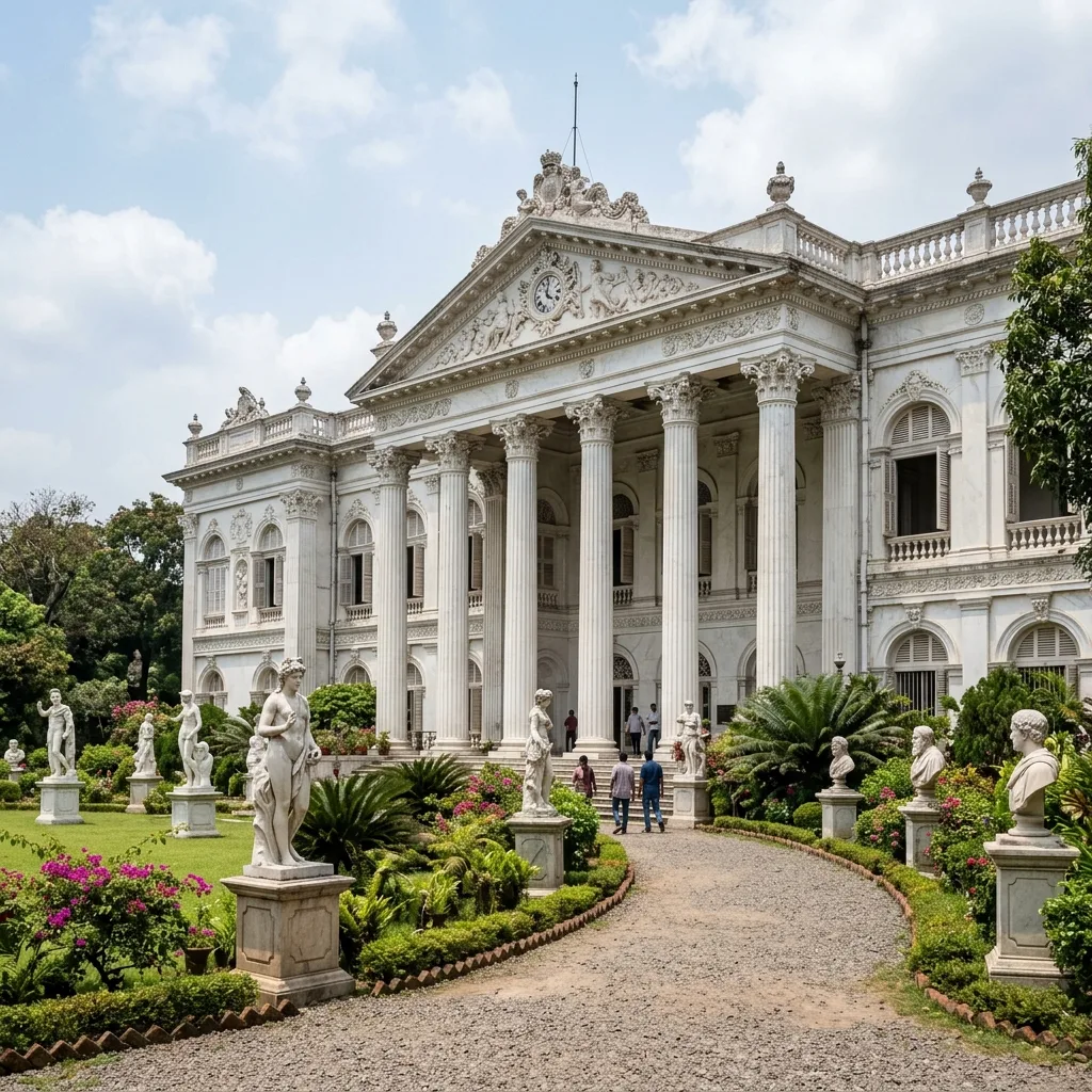
Sealdah reflects Kolkata's multi-faith heritage. Historic places of worship include the **Moulali Dargah** (a 400-year-old Sufi shrine), **Thanthania Kalibari** (1803), **Magen David Synagogue** (1884), and the Portuguese **Holy Rosary Cathedral** in Bowbazar (1799), serving as testimonies to early immigrant populations.

12. Sealdah Today

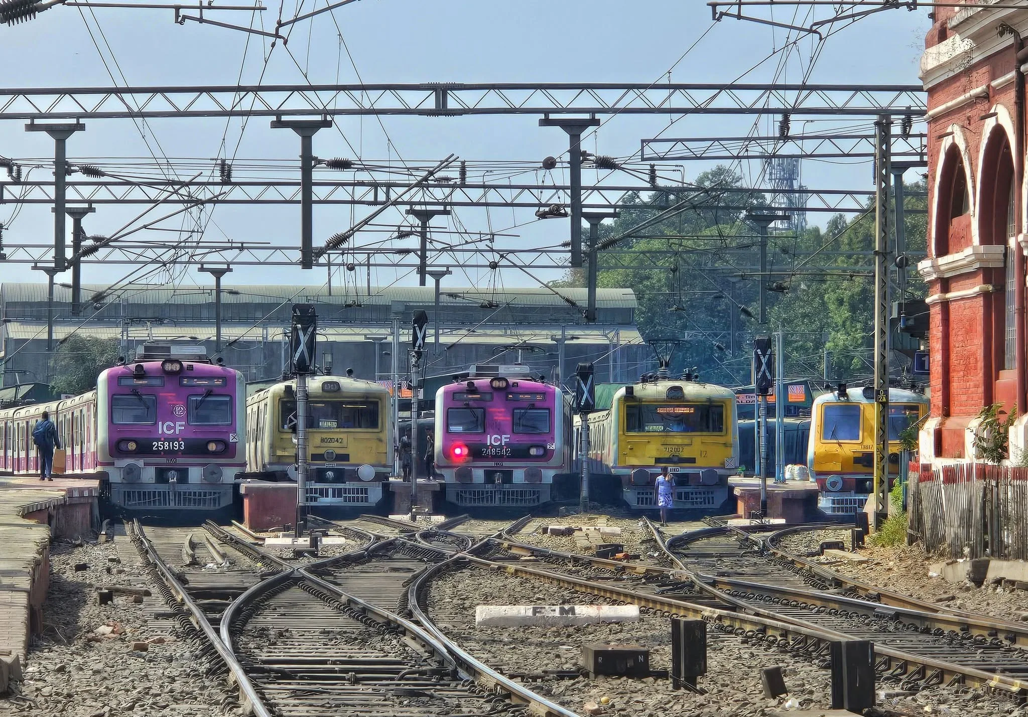
Today, Sealdah is an integrated transit hub. The main railway terminal operates 21 platforms, handling thousands of suburban and long-distance trains daily. The integration with the underground Green Line Metro has further enhanced connectivity, linking Sealdah to Salt Lake Sector V and Howrah in minutes.

Self-Guided Tour

Suggested Heritage Walk Route

Walk Overview:

Route: Sealdah Station → Baithakkhana → College Street → Coffee House → Bow Barracks → Tiretta Bazaar → Marble Palace → Jorasanko
Walking Distance: 5.8 km
Time Required: 3 Hours
Best Time: Sunday mornings (7:00 AM - 10:00 AM) due to low traffic.
Google Maps Route

Photography & Food Tips:

  • Photography: Bring a standard zoom lens (24-70mm) to capture street scenes and colonial brick textures.
  • Nearby Food: Eat hing kachoris at Putiram (College Street) or drink Hot Infusion Coffee at Coffee House.

13. Historical Timeline

1690

Job Charnock resting site

Job Charnock rests under the shade of the grand Baithakkhana Peepul tree in Sealdah, smoking tobacco, initiating early trade connections before consolidating Calcutta.

1756

Siraj-ud-daulah crosses Sealdah

Nawab Siraj-ud-daulah leads his royal troops across the Maratha Ditch at Sealdah to capture British Fort William in the Battle of Calcutta.

1857

Eastern Bengal Railway incorporation

The Eastern Bengal Railway company is formally incorporated in London to connect Calcutta to the eastern districts of Bengal.

1862

Sealdah Railway Station construction

Construction of the initial tin-roofed railway terminal in Sealdah opens, linking Calcutta to Kushtia (modern-day Bangladesh).

1869

Walter Glanville building opens

Architect Walter Glanville completes the neoclassical brick facade of Sealdah Station, laying the foundation of modern railway transit.

1902

First electric tram route

Kolkata's tram network is electrified, running regular routes from Sealdah Station to Esplanade via Bowbazar.

1947

Partition and refugee migration

Sealdah Station becomes the primary entry point for millions of refugees migrating from East Pakistan during the partition of India.

1950

Suburban railway electrification

Suburban railway tracks around Sealdah are electrified, paving the way for fast commuter local train connections.

1984

Sealdah Flyover construction

Construction of the Vidyapati Setu (Sealdah Flyover) begins to bypass traffic congestion on Acharya Prafulla Chandra Road.

2000

Digital ticketing systems

Sealdah Station deploys computerized booking counters, replacing vintage paper cards for local and mail train lines.

2010

Terminal expansions

Sealdah Station builds new passenger lobbies, footbridges, and expands platforms to accommodate 21-coach train arrays.

2020

East-West Metro construction

Construction of the deep Sealdah Metro station begins, designed to link Sealdah with Sector V and Howrah.

Present Day

Integrated transit hub

Sealdah operates as India's busiest transit corridor, serving over 1.8 million daily commuters via local trains, metro, buses, and trams.

14. Sealdah: Then vs Now

AspectOld Sealdah (Colonial)Modern Sealdah (Present)
TransportHorse-drawn carriages, manual rickshaws, steam engines, and manual handcars.East-West Metro, electrified local trains, air-conditioned buses, app cabs.
MarketsRustic wholesale open-air vegetable yards under Peepul trees (Baithakkhana).Bustling permanent commercial networks (Kolay Market, Baithakkhana paper market).
ArchitectureTin-roofed railway sheds, colonial red-brick bungalows, and Maratha Ditch clay banks.Neoclassical station facade, modern concrete flyover, high-tech underground metro lobbies.
PopulationA collection of 38 marshy villages (Dihi Panchannagram) with sparse settlements.One of the most densely populated commercial and railway zones in the Indian subcontinent.

15. 50 Interesting Facts About Sealdah

Job Charnock chosen site of Kolkata for a city due to the pleasure he found in sitting and smoking under the shade of the large Peepul tree of Baithakkhana, Sealdah.
The name 'Sealdah' is derived from 'Sheal' (jackal) and 'Daha' (a pool or lake), reflecting the jackal-infested marshland of early Calcutta.
The Maratha Ditch, dug in 1742 as a defense line, ran along APC Road (now Sealdah) and was later filled in 1799 to make roads.
Sealdah was once part of Dihi Panchannagram, a cluster of 55 villages purchased by the British from Nawab Mir Jafar in 1758.
The first railway terminal in Sealdah was opened in 1862 and had a simple tin-roofed shed structure.
The permanent neoclassical brick station building was designed by English architect Walter Glanville and opened in 1869.
Kolkata's first horse-driven tramway began operations from Sealdah Station to Armenian Ghat in 1873.
Mahatma Gandhi Road (originally Harrison Road) was built in 1889 to directly connect Sealdah Station to the Hooghly River.
Harrison Road was the first street in Calcutta to be illuminated by electricity, powered by the Calcutta Electric Supply Corporation.
The grand Peepul tree of Baithakkhana was cut down in the late 19th century to make way for Harrison Road tram tracks.
During the partition of India in 1947, Sealdah Station served as a temporary home for millions of refugees migrating from East Pakistan.
NRS Medical College (originally Campbell Medical School) was established in Sealdah in 1873.
Dr. R. Ahmed Dental College in Sealdah is the oldest dental college in India, founded by Dr. Rafiuddin Ahmed in 1920.
Surendranath College was founded in Sealdah in 1884 by prominent freedom fighter Surendranath Banerjee.
The Sealdah Flyover (Vidyapati Setu) was constructed to bypass traffic congestion on APC Road and Bowbazar crossings.
Sealdah Station's South Section and North Section were once operated by different private railway companies.
The Eastern Bengal Railway was nationalized by the British government in 1884 due to its high strategic value.
Steam locomotives operated on Sealdah's suburban lines until they were fully phased out in the 1965 electrification drive.
Sealdah Station serves over 1.8 million passengers daily, making it one of the busiest railway stations in the world.
The Sealdah Metro Station is built at a depth of over 17 meters, making it one of the deepest metro hubs in India.
Mullick Ghat Flower Market, located a short distance away, is the largest wholesale flower market in Asia.
Tiretta Bazaar, situated near Sealdah, is India's only surviving Old Chinatown morning breakfast market.
Bow Barracks, a red-brick block near Sealdah, was built during WWI as a mess hall for British military officers.
Writers' Building at B.B.D. Bagh, a short distance away, was the original administrative hub of the East India Company.
College Street (Boi Para) near Sealdah is the second largest second-hand book market in the world.
The historic Calcutta University was founded in 1857, with its main senate campus located near Sealdah.
Presidency University (originally Hindu College) was established in 1817, making it one of the oldest modern colleges in Asia.
Moulali Dargah near Sealdah is a 400-year-old Sufi shrine that attracts people of all faiths.
The historic Thanthania Kalibari temple was founded in 1803, famous for its clay image of Siddheshwari Kali.
Magen David Synagogue, located near Sealdah, is a beautiful red-brick Italianate structure built by Jewish merchants in 1884.
Job Charnock's octagonal brick mausoleum is situated in the graveyard of St. John's Church, a short distance from Sealdah.
Nilsratan Sircar Medical College (NRS) was renamed in honor of the legendary Bengali physician Sir Nilratan Sircar.
B.R. Singh Hospital in Sealdah was established by the railways in 1934 to treat transit staff and locals.
Surendranath College was originally named Ripon College after the British Viceroy Lord Ripon.
The historic paper market of Baithakkhana is the largest paper trading hub in Eastern India.
Kolkata's first electrified tram ran from Esplanade to Kidderpore in 1902, and soon extended to Sealdah in 1905.
The Circular Railway of Kolkata has a dedicated station at Sealdah called Sealdah Court.
The East-West Metro tunnel crosses under the active railway tracks at Sealdah Station using advanced micro-tunnelling shields.
Siraj-ud-daulah's troops fought the British forces in the marshy paddy fields of Sealdah before capturing Fort William in 1756.
The Maratha Ditch was dug to prevent Bargi (Maratha cavalry) raiders from looting Calcutta.
Tiretta Bazaar is named after Edward Tiretta, an Italian land surveyor who served as the civil architect of Calcutta in the 1780s.
The Bowbazar street market is famous for heritage gold jewelry shops operating since the late 19th century.
Job Charnock's Peepul tree resting spot was mentioned in the historical travel diary of British merchant Alexander Hamilton.
The Eastern Bengal Railway originally connected Calcutta to Kushtia, which is now a major district in Bangladesh.
Subhash Sarobar, located east of Sealdah, is a historic lake park developed for water sports and local festivals.
The currency building at Dalhousie, a short walk away, originally housed the government mint and financial offices.
The Roman Catholic Cathedral of the Holy Rosary in Bowbazar was founded in 1799 by Portuguese merchants.
The first dissection of a human body in Asia took place at Calcutta Medical College in 1836 by Pandit Madhusudan Gupta.
Scottish Church College near Sealdah was established in 1830 by Alexander Duff, the first missionary of the Church of Scotland.
Sealdah remains the primary gateway linking Kolkata with the Sundarbans delta via the South Division local lines.

Nearby Historical Attractions

Related Portal Pages

Sealdah History FAQs

Frequently asked questions about etymology, railway construction, transport, education, and heritage spots around Sealdah.

1. What is the ancient name of Sealdah?
In ancient records, the area was known as Shrigaldwipa, which translates to 'Jackal Island' due to the swampy wetlands and forests populated by jackals.
2. Where does the name Sealdah come from?
The name is derived from the Bengali words 'Sheal' (jackal) and 'Daha' (pool or lake), referring to the water bodies where jackals gathered.
3. What was Baithakkhana in old Sealdah?
Baithakkhana was an open resting place centered around a giant Peepul tree, where merchants from eastern districts gathered before entering Calcutta.
4. Did Job Charnock visit Sealdah?
Yes, historical accounts record that Job Charnock often rested and smoked tobacco under the shade of the Baithakkhana Peepul tree in Sealdah.
5. What was Nawab Siraj-ud-daulah's connection to Sealdah?
In 1756, Nawab Siraj-ud-daulah led his army across the Maratha Ditch at Sealdah to capture British Fort William during the Battle of Calcutta.
6. What was the Maratha Ditch?
It was a defensive ditch dug in 1742 to protect Calcutta from Maratha Bargi raiders, running along modern APC Road in Sealdah.
7. What was Dihi Panchannagram?
It was a cluster of 55 villages purchased by the British in 1758 from Nawab Mir Jafar. Sealdah was one of these village administrative blocks.
8. When was the Maratha Ditch filled up?
The Maratha Ditch was filled in 1799 to make way for the Circular Road (now Acharya Prafulla Chandra Road).
9. Who was Siraj-ud-daulah?
He was the last independent Nawab of Bengal, Bihar, and Orissa, whose defeat at Plassey in 1757 marked the rise of British rule in India.
10. How did Sealdah shape Kolkata's growth?
Sealdah acted as the eastern gateway, connecting the city to the fertile districts of East Bengal, facilitating trade, food supply, and mass migration.
11. What was Harrison Road?
Harrison Road (now M.G. Road) was built in 1889 to directly connect Sealdah Station with the Hooghly River crossings.
12. What was the first street in Kolkata to have electricity?
Harrison Road (M.G. Road) near Sealdah was the first street illuminated by electric lights in 1889.
13. What happened to the Baithakkhana Peepul tree?
The tree was cut down in the late 19th century during the construction of Harrison Road to lay down tram tracks.
14. When was Sealdah Railway Station built?
The first station terminal, a simple tin-roofed railway shed, was opened to passengers in 1862.
15. Who designed the Sealdah Station building?
The permanent neoclassical red-brick facade building was designed by English architect Walter Glanville and completed in 1869.
16. What was the Eastern Bengal Railway?
It was a private railway company incorporated in London in 1857 to connect Calcutta to Eastern Bengal, later nationalized in 1884.
17. Where did the first train from Sealdah go?
The first train from Sealdah in 1862 ran to Kushtia (which is now a major district in Bangladesh).
18. When was Sealdah Station electrified?
The suburban railway tracks at Sealdah were electrified in stages between 1957 and 1963, replacing steam locomotives.
19. Why is Sealdah Station historically important?
It was the main gateway connecting East and West Bengal, and played a critical role during the 1947 refugee crisis.
20. How many sections does Sealdah Station have?
Sealdah Station is split into three terminals: Sealdah North, Sealdah Main, and Sealdah South.
21. When did steam engines stop running at Sealdah?
Steam engines were completely phased out of Sealdah's suburban commuter tracks by 1965.
22. What is the daily passenger statistics of Sealdah?
Sealdah serves approximately 1.8 to 2 million daily passengers, making it one of the busiest stations in India.
23. Is Sealdah Court a railway station?
Sealdah Court is a station on the Circular Railway network, located adjacent to the main Sealdah terminal.
24. Was Sealdah Station affected by the partition?
Yes, it was flooded with millions of refugees from East Pakistan, serving as a massive transit camp for years.
25. What is the connection between Sealdah and Bangladesh?
Sealdah originally linked Calcutta to Kushtia and Goalundo Ghat (Bangladesh) and today hosts the Maitree Express to Dhaka.
26. When did horse-drawn trams start in Sealdah?
Kolkata's first horse-driven tramway began operations from Sealdah Station to Armenian Ghat in 1873.
27. When was the tram network electrified in Sealdah?
Trams running through the Sealdah and Bowbazar routes were electrified in 1905.
28. What is the Sealdah Flyover called?
The Sealdah Flyover is officially named Vidyapati Setu, constructed to ease traffic on APC Road.
29. When was the East-West Metro station opened at Sealdah?
The Sealdah Metro Station on the Green Line was opened to the public in July 2022.
30. How deep is the Sealdah Metro Station?
The Sealdah Metro Station is built at a depth of 17 meters, featuring advanced underground lobbies.
31. What transit modes connect at Sealdah?
Commuters can transition between local trains, underground metro, public buses, trams, and taxi ranks.
32. What is the Circular Railway?
It is a suburban loop line circling Kolkata, with Sealdah Court serving as a key eastern terminal station.
33. Did steam trams ever run in Sealdah?
Steam-powered tram engines were briefly introduced in 1882 but were soon replaced due to smoke pollution.
34. How can I travel to the airport from Sealdah?
You can take direct buses from Sealdah Flyover, local trains to Dum Dum, or hire prepaid yellow cabs.
35. Are hand-pulled rickshaws still active in Sealdah?
Yes, hand-pulled rickshaws are still active in the heritage lanes of Bowbazar and Baithakkhana.
36. Which university is nearest to Sealdah?
The historic University of Calcutta, founded in 1857, has its main College Street campus near Sealdah.
37. When was Presidency University established?
Presidency University (originally founded as Hindu College) was established in College Street in 1817.
38. What is Boi Para near Sealdah?
Boi Para is the local name for the College Street book market, the second largest second-hand book market globally.
39. When was Surendranath College founded?
Surendranath College was founded in Sealdah in 1884 by prominent nationalist leader Surendranath Banerjee.
40. What was Ripon College?
Surendranath College was originally named Ripon College in honor of British Viceroy Lord Ripon.
41. When was Scottish Church College established?
Scottish Church College was established in 1830 by Scottish missionary Alexander Duff.
42. Is NRS a heritage medical college?
Yes, Nilsratan Sircar Medical College (NRS) was founded in 1873 as the Campbell Medical School.
43. Where did the first human body dissection in Asia occur?
The first dissection occurred at Calcutta Medical College in 1836, led by Pandit Madhusudan Gupta.
44. Who was Dr. Rafiuddin Ahmed?
He was the founder of Dr. R. Ahmed Dental College in Sealdah (1920), the oldest dental school in India.
45. What is the paper market in Sealdah?
The Baithakkhana Paper Market near Sealdah is the largest wholesale paper and printing market in Eastern India.
46. What is Kolay Market?
Kolay Market is one of Asia's largest wholesale vegetable markets, operating 24/7 adjacent to Sealdah Station.
47. When does Tiretta Bazaar Chinese breakfast start?
The Chinese breakfast market starts at 6:00 AM and winds up by 9:00 AM daily, near Central Metro.
48. What is Bowbazar famous for?
Bowbazar is famous for its historic gold and diamond jewelry showrooms operating since the 19th century.
49. When was New Market built?
Originally called Sir Stuart Hogg Market, it was built by the British in Esplanade in 1874.
50. Is Burrabazar close to Sealdah?
Yes, Burrabazar, India's largest wholesale market, is located about 4 km west of Sealdah Station.
51. What architectural style is Sealdah Station?
It is designed in the British neoclassical railway architecture style by architect Walter Glanville.
52. What is Bow Barracks?
It is a red-brick residential block built during WWI to house British soldiers in Central Kolkata.
53. What is the Currency Building?
A restored Italianate dome structure from 1833 in Dalhousie, originally housing financial offices.
54. What is Metcalfe Hall?
A heritage building in B.B.D. Bagh featuring 30 massive stone pillars, modeled after the Temple of Winds.
55. What is Writers' Building?
The massive red-brick baroque structure in B.B.D. Bagh that housed the clerks of East India Company.
56. Where is the oldest dental college in India?
Dr. R. Ahmed Dental College is located on APC Road in Sealdah, founded in 1920.
57. What is Job Charnock's Mausoleum?
It is the octagonal brick tomb of Job Charnock, built in 1695 inside the graveyard of St. John's Church.
58. Who was Sir Nilratan Sircar?
He was a legendary Bengali physician and educator, after whom the NRS Medical College is named.
59. What is B.R. Singh Hospital?
It is a historic railway hospital in Sealdah established in 1934 to treat rail employees.
60. Is there a museum at Jorasanko Thakurbari?
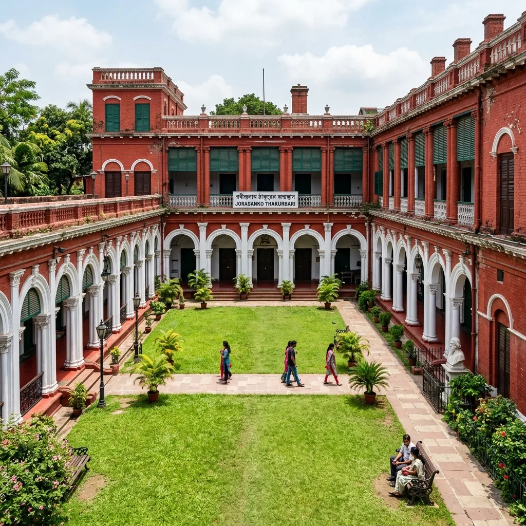
Yes, the ancestral home of Rabindranath Tagore is now a museum showcasing paintings and manuscripts.
61. What is the significance of Indian Coffee House?
It was the intellectual storm center of the Bengal Renaissance, frequented by Satyajit Ray and Amartya Sen.
62. What is the walking route of Sealdah Heritage Walk?
The route is: Sealdah Station → Baithakkhana → College Street → Coffee House → Bow Barracks → Tiretta Bazaar → Marble Palace → Jorasanko.
63. What is the distance of the Heritage Walk?
The walking route covers approximately 5.8 km and takes about 3 hours to explore.
64. Is photography allowed inside Marble Palace?
Handheld photography is allowed, but you must get a free permit from the West Bengal Tourism Office first.
65. Which is the nearest metro to Jorasanko Thakurbari?
Girish Park Metro Station on the Blue Line is the nearest metro station to the Tagore House.
66. What is the ancient name of Sealdah?
In ancient records, the area was known as Shrigaldwipa, which translates to 'Jackal Island' due to the swampy wetlands and forests populated by jackals.
67. Where does the name Sealdah come from?
The name is derived from the Bengali words 'Sheal' (jackal) and 'Daha' (pool or lake), referring to the water bodies where jackals gathered.
68. What was Baithakkhana in old Sealdah?
Baithakkhana was an open resting place centered around a giant Peepul tree, where merchants from eastern districts gathered before entering Calcutta.
69. Did Job Charnock visit Sealdah?
Yes, historical accounts record that Job Charnock often rested and smoked tobacco under the shade of the Baithakkhana Peepul tree in Sealdah.
70. What was Nawab Siraj-ud-daulah's connection to Sealdah?
In 1756, Nawab Siraj-ud-daulah led his army across the Maratha Ditch at Sealdah to capture British Fort William during the Battle of Calcutta.
71. What was the Maratha Ditch?
It was a defensive ditch dug in 1742 to protect Calcutta from Maratha Bargi raiders, running along modern APC Road in Sealdah.
72. What was Dihi Panchannagram?
It was a cluster of 55 villages purchased by the British in 1758 from Nawab Mir Jafar. Sealdah was one of these village administrative blocks.
73. When was the Maratha Ditch filled up?
The Maratha Ditch was filled in 1799 to make way for the Circular Road (now Acharya Prafulla Chandra Road).
74. Who was Siraj-ud-daulah?
He was the last independent Nawab of Bengal, Bihar, and Orissa, whose defeat at Plassey in 1757 marked the rise of British rule in India.
75. How did Sealdah shape Kolkata's growth?
Sealdah acted as the eastern gateway, connecting the city to the fertile districts of East Bengal, facilitating trade, food supply, and mass migration.
76. What was Harrison Road?
Harrison Road (now M.G. Road) was built in 1889 to directly connect Sealdah Station with the Hooghly River crossings.
77. What was the first street in Kolkata to have electricity?
Harrison Road (M.G. Road) near Sealdah was the first street illuminated by electric lights in 1889.
78. What happened to the Baithakkhana Peepul tree?
The tree was cut down in the late 19th century during the construction of Harrison Road to lay down tram tracks.
79. When was Sealdah Railway Station built?
The first station terminal, a simple tin-roofed railway shed, was opened to passengers in 1862.
80. Who designed the Sealdah Station building?
The permanent neoclassical red-brick facade building was designed by English architect Walter Glanville and completed in 1869.
81. What was the Eastern Bengal Railway?
It was a private railway company incorporated in London in 1857 to connect Calcutta to Eastern Bengal, later nationalized in 1884.
82. Where did the first train from Sealdah go?
The first train from Sealdah in 1862 ran to Kushtia (which is now a major district in Bangladesh).
83. When was Sealdah Station electrified?
The suburban railway tracks at Sealdah were electrified in stages between 1957 and 1963, replacing steam locomotives.
84. Why is Sealdah Station historically important?
It was the main gateway connecting East and West Bengal, and played a critical role during the 1947 refugee crisis.
85. How many sections does Sealdah Station have?
Sealdah Station is split into three terminals: Sealdah North, Sealdah Main, and Sealdah South.
86. When did steam engines stop running at Sealdah?
Steam engines were completely phased out of Sealdah's suburban commuter tracks by 1965.
87. What is the daily passenger statistics of Sealdah?
Sealdah serves approximately 1.8 to 2 million daily passengers, making it one of the busiest stations in India.
88. Is Sealdah Court a railway station?
Sealdah Court is a station on the Circular Railway network, located adjacent to the main Sealdah terminal.
89. Was Sealdah Station affected by the partition?
Yes, it was flooded with millions of refugees from East Pakistan, serving as a massive transit camp for years.
90. What is the connection between Sealdah and Bangladesh?
Sealdah originally linked Calcutta to Kushtia and Goalundo Ghat (Bangladesh) and today hosts the Maitree Express to Dhaka.
91. When did horse-drawn trams start in Sealdah?
Kolkata's first horse-driven tramway began operations from Sealdah Station to Armenian Ghat in 1873.
92. When was the tram network electrified in Sealdah?
Trams running through the Sealdah and Bowbazar routes were electrified in 1905.
93. What is the Sealdah Flyover called?
The Sealdah Flyover is officially named Vidyapati Setu, constructed to ease traffic on APC Road.
94. When was the East-West Metro station opened at Sealdah?
The Sealdah Metro Station on the Green Line was opened to the public in July 2022.
95. How deep is the Sealdah Metro Station?
The Sealdah Metro Station is built at a depth of 17 meters, featuring advanced underground lobbies.
96. What transit modes connect at Sealdah?
Commuters can transition between local trains, underground metro, public buses, trams, and taxi ranks.
97. What is the Circular Railway?
It is a suburban loop line circling Kolkata, with Sealdah Court serving as a key eastern terminal station.
98. Did steam trams ever run in Sealdah?
Steam-powered tram engines were briefly introduced in 1882 but were soon replaced due to smoke pollution.
99. How can I travel to the airport from Sealdah?
You can take direct buses from Sealdah Flyover, local trains to Dum Dum, or hire prepaid yellow cabs.
100. Are hand-pulled rickshaws still active in Sealdah?
Yes, hand-pulled rickshaws are still active in the heritage lanes of Bowbazar and Baithakkhana.